List of mountains of the United States
Jump to navigation
Jump to search
This list includes significant mountain peaks and high points located in the United States arranged alphabetically by state, district, or territory. The highest peak or point in each state, district or territory is noted in bold.
Significant mountain peaks and high points[edit]
Alabama[edit]
- Brindley Mountain
- Cheaha Mountain, highest summit in the State of Alabama
- Halama Mountain
Alaska[edit]
- Afognak Mountain, summit of Afognak Island
- Amak Volcano, active stratovolcano
- Amherst Peak
- Amulet Peak
- Andy Simons Mountain
- Annex Peak
- Anvil Peak NGS PB, active stratovolcano that forms the summit of Semisopochnoi Island
- Arthur Peak
- Asses Ears (Alaska)
- Atna Peaks PB
- Atuk Mountain PB, summit of St. Lawrence Island
- Augustine Volcano, active lava dome that forms the summit of Augustine Island
- Auke Mountain
- Baranof Island High Point PB, summit of Baranof Island
- Bard Peak
- Bashful Peak
- Bear Mountain
- Begich Peak
- Benign Peak
- Black Cap Mountain
- Black Mountain
- Black Mountain PB, highest summit of the De Long Mountains
- Black Peak
- Blackthorn Peak
- Boggs Peak
- Bonanza Peak
- Buldir Volcano PB, stratovolcano that forms the summit of Buldir Island
- Bullard Mountain
- Calliope Mountain
- Cantata Peak
- Carlisle Peak, active stratovolcano that forms the summit of Carlisle Island
- Carpathian Peak
- Castle Mountain
- Castle Peak
- Cathedral Peak
- Cecil Rhode Mountain
- Chichagof Island High Point, summit of Chichagof Island
- Chitistone Mountain
- Cleveland Volcano NGS PB, active stratovolcano that forms the summit of Chuginadak Island
- Cloud Peak PB, highest summit of the Philip Smith Mountains
- Cold Bay Volcano
- Columbia Peak
- De Long Mountains High Point PB
- Debauch Mountain PB
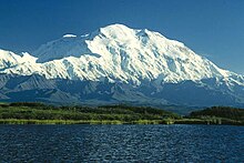
- Denali (Mount McKinley) PB, highest summit of the Alaska Range, the State of Alaska, the United States of America, and all of North America
- Devils Paw PB
- Dillingham High Point PB
- Dillon Mountain
- Divide Mountain
- Donoho Peak
- Double Peak
- Eagle Peak, on Admiralty Island
- Eagle Peak, in Chugach Mountains
- East Peak
- Ellamar Mountain
- Emperor Peak
- Face Mountain
- Fang Mountain
- Fireweed Mountain
- Flat Top Mountain (Sitka City and Borough, Alaska)
- Flattop Mountain (Anchorage, Alaska)
- Frosty Peak PB, stratovolcano
- Girls Mountain
- Goat Mountain
- Granite Peak
- Granite Range High Point PB
- Great Nunatak
- Great Sitkin Volcano PB, active stratovolcano that forms the summit of Great Sitkin Island
- Guardian Mountain
- Gunsight Mountain
- Hanagita Peak NGS PB
- Heintzleman Ridge
- Hess Mountain
- Highbush Peak
- Hinchinbrook Island High Point, summit of Hinchinbrook Island
- Hogback Ridge
- Horn Spire
- Isanotski Peaks PB, stratovolcano
- Isthmus Peak PB
- Joshua Green Peak
- Kates Needle PB
- Kichatna Spire PB
- Kings Mountain
- Kiska Volcano PB
- Knight Island High Point, summit of Knight Island
- Koniag Peak PB, summit of Kodiak Island
- Korovin Volcano PB, active stratovolcano forms the summit of Atka Island
- Lingon Mountain
- Lions Head Mountain
- London Tower
- Lowell Peak
- Makushin Volcano PB, active stratovolcano
- Mammary Peak
- Mangy Hill
- Marble Mountain
- Matanuska Peak
- Maynard Mountain
- McGinnis Mountain
- McGinnis Peak
- McHugh Peak
- Mentasta Mountains High Point PB
- Meteorite Mountain
- Moby Dick
- Montague Island High Point, summit of Montague Island
- Mount Abbe
- Mount Abdallah
- Mount Adagdak, stratovolcano
- Mount Adair
- Mount Akutan PB, active stratovolcano that forms the summit of Akutan Island
- Mount Alice
- Mount Alpenglow
- Mount Alverstone PB
- Mount Amukta, active stratovolcano
- Mount Angayukaqsraq PB, highest summit of the Baird Mountains
- Mount Aniakchak, active stratovolcano
- Mount Ascension
- Mount Augusta PB
- Mount Barrille
- Mount Bassie
- Mount Bayard
- Mount Bear PB
- Mount Bendeleben
- Mount Benson
- Mount Bertha
- Mount Blachnitzky
- Mount Blackburn NGS PB, highest summit of the Wrangell Mountains
- Mount Bona PB
- Mount Bradley
- Mount Bradley (Mount Jumbo)
- Mount Cameron
- Mount Carlisle, active stratovolcano
- Mount Carmack
- Mount Case
- Mount Castner
- Mount Chamberlin PB, highest summit of the Brooks Range and the Arctic United States
- Mount Chiginagak PB, active stratovolcano
- Mount Chitina
- Mount Cook (Saint Elias Mountains) PB
- Mount Cooper
- Mount Crillon PB
- Mount Dagelet
- Mount Deborah PB
- Mount Defiant
- Mount Douglas PB, active stratovolcano
- Mount Drum PB, stratovolcano
- Mount Dutton, active stratovolcano
- Mount Edgecumbe, stratovolcano that forms the summit of Kruzof Island
- Mount Edison
- Mount Eielson
- Mount Einstein
- Mount Elusive
- Mount Emmons
- Mount Ernest Gruening
- Mount Etolin, summit of Etolin Island
- Mount Fairweather (Fairweather Mountain) PB
- Mount Foraker PB
- Mount Forde
- Mount Foresta PB
- Mount Frances
- Mount Francis
- Mount Gareloi, active stratovolcano that forms the summit of Gareloi Island. Westernmost ultra-prominent summit of greater North America.
- Mount Gilbert, volcano that forms the summit of Akun Island
- Mount Gilbert (Chugach Mountains)
- Mount Glenn
- Mount Golub
- Mount Goode
- Mount Grace
- Mount Griggs PB, active stratovolcano
- Mount Grosvenor
- Mount Grosvenor (Alaska Range)
- Mount Harding
- Mount Harper PB
- Mount Hayes PB, stratovolcano remnant
- Mount Healy
- Mount Hesperus PB
- Mount Hogan
- Mount Hubbard PB
- Mount Hunter PB
- Mount Huntington
- Mount Huxley
- Mount Igikpak PB, highest summit of the Schwatka Mountains
- Mount Iliamna, active stratovolcano
- Mount Jarvis PB
- Mount Johnson
- Mount Juneau
- Mount Kagamil, active stratovolcano that forms the summit of Kagamil Island
- Mount Kaguyak, stratovolcano
- Mount Kanaga, active stratovolcano that forms the summit of Kanaga Island
- Mount Katmai, active stratovolcano
- Mount Kimball PB
- Mount Kiska, active stratovolcano that forms the summit of Kiska Island
- Mount Kudlich
- Mount La Perouse
- Mount Mageik, active volcano
- Mount Marcus Baker PB
- Mount Martin, active stratovolcano
- Mount Mather PB
- Mount McGinnis[1]
- Mount Merriam
- Mount Michelson (Brooks Range)
- Mount Michelson (Chugach Mountains)
- Mount Miller PB
- Mount Moffett, stratovolcano that forms the summit of Adak Island
- Mount Muir
- Mount Nagishlamina
- Mount Natazhat PB
- Mount Neacola PB
- Mount Okmok, active shield volcano
- Mount O'Neel
- Mount Osborn NGS PB
- Mount Palmer
- Mount Pavlof PB, active stratovolcano
- Mount POW/MIA
- Mount Prindle PB
- Mount Queena
- Mount Quincy Adams (Fairweather Range)
- Mount Recheshnoi, active stratovolcano
- Mount Redoubt NGS PB, active stratovolcano that forms the highest summit of the Chigmit Mountains
- Mount Reid, summit of Revillagigedo Island
- Mount Ripinski
- Mount Robert Barron
- Mount Roberts
- Mount Rumble
- Mount Russell PB
- Mount Saint Elias PB, highest summit of Wrangell-St. Elias National Park and Preserve and the second highest summit of both the United States and Canada
- Mount Sanford PB, volcano
- Mount Seattle PB
- Mount Seguam, active stratovolcano
- Mount Shand
- Mount Shishaldin PB, active stratovolcano that forms the summit of Unimak Island
- Mount Silverthrone PB
- Mount Spurr, active stratovolcano
- Mount Steller (Chugach Mountains) NGS PB, stratovolcano
- Mount Susitna
- Mount Thomas
- Mount Tom White
- Mount Torbert PB
- Mount Tozi PB
- Mount Turner
- Mount Vancouver
- Mount Veniaminof PB, active stratovolcano
- Mount Vsevidof PB, active stratovolcano that forms the summit of Umnak Island
- Mount Wake
- Mount Watson
- Mount Westdahl, active volcano
- Mount Wickersham
- Mount Williams
- Mount Williwaw
- Mount Witherspoon
- Mount Wordie
- Mount Wrangell PB, active shield volcano
- Mount Wrather
- Novarupta, active lava dome
- Nugget Mountain
- Nugget Towers
- O'Malley Peak
- Passage Peak
- Pavlof Sister, stratovolcano
- Peak 5390
- Peak 6200
- Peak 6915
- Peak 8010 PB
- Peak 8084 PB
- Peak 8336 PB
- Peak 8488 PB
- Pease Peak
- Penguin Peak
- Phoenix Peak
- Pilot Peak
- Pioneer Peak
- Pogromni Volcano NGS PB
- Polar Bear Peak
- Polychrome Mountain
- Porphyry Mountain
- Portage Peak
- Poss Mountain
- Prince of Wales Island High Point PB, summit of Prince of Wales Island
- Princess Peak
- Pyramid Mountain
- Pyramid Peak
- Pyre Peak PB, summit of Seguam Island
- Radio Control Tower
- Regal Mountain NGS PB
- Resurrection Peaks
- Rhino Peak
- Sanak Peak, summit of Sanak Island
- Scott Peak
- Segula Peak, stratovolcano that forms the summit of Segula Island
- Sentinel Peak
- Sheep Mountain
- Shishaldin Volcano, see Mount Shishaldin
- Sinclair Mountain
- Slanting Peak
- Snider Peak
- Snowpatch Crag
- Snow Tower PB
- Sourdough Peak
- Sovereign Mountain PB
- Split Thumb
- Stroller White Mountain
- Sugar Loaf Mountain
- Sukakpak Mountain
- Taku Towers
- Tanaga Volcano PB, active stratovolcano that forms the summit of Tanaga Island
- Tazlina Tower
- The Mitre
- The Ramp
- The Rooster Comb
- The Snow Towers
- Thibodeaux Mountain, highest summit of the Endicott Mountains
- Tokosha Mountains
- Tressider Peak PB
- Trident Volcano PB, active stratovolcano
- Truuli Peak PB
- Tukgahgo Mountain
- Twin Peaks
- Ugashik-Peulik, active stratovolcano
- Ultima Thule Peak
- University Peak PB
- Kusilvak High Point PB
- Wiki Peak
- Williams Peak
- Wolverine Peak
- Yantarni Volcano
American Samoa[edit]
- A‘oloaufou
- Lata Mountain, summit of the Island of Ta‘ū and the highest summit of the Territory of American Samoa
- Matafao Peak, summit of the Island of Tutuila
- Piumafua, summit of the Island of Olosega
- Rainmaker Mountain (North Pioa Mountain)
- Tumu, summit of the Island of Ofu
Arizona[edit]
- Agassiz Peak
- Agathla Peak
- Ajo Peak
- Alsap Butte
- Angels Gate
- Baboquivari Peak
- Mount Baldy
- Mount Bigelow
- Black Mesa (western Arizona)
- Brady Peak
- Brahma Temple
- Camelback Mountain
- Chiricahua Peak
- Chuar Butte
- Comanche Point
- Confucius Temple
- Coyote Buttes
- Diana Temple
- Doyle Peak
- Daisy Mountain[2]
- Escudilla Mountain
- Four Peaks
- Fremont Peak
- Freya Castle
- Geikie Peak
- Granite Mountain
- Gu Achi Peak
- Holy Grail Temple
- Hualapai Peak
- Humphreys Peak, highest summit of the State of Arizona
- Jupiter Temple
- Kaibab Plateau High Point
- Kendrick Peak
- Kitt Peak
- Miller Peak
- Mingus Mountain
- Mount Ajo
- Mount Elden
- Mount Graham
- Mount Hayden
- Mount Hopkins
- Mount Huethawali
- Mount Lemmon
- Mount Sinyella
- Mount Tipton
- Mount Union
- Mount Wrightson
- Navajo Mountain
- Picketpost Mountain
- Piestewa Peak
- Pollux Temple
- Pusch Ridge
- Ragged Top
- Red Butte
- Roof Butte
- San Francisco Peaks, four highest summits of Arizona
- Sentinel Peak (A Mountain)
- Shiva Temple
- SP Crater
- Steamboat Mountain
- Sunnyslope Mountain
- Sunset Crater
- Superstition Mountain
- Tempe Butte
- Thimble Peak
- Thompson Peak
- Thor Temple
- Vishnu Temple
- Zoroaster Temple
Arkansas[edit]
- Mount Magazine, highest summit of the State of Arkansas
- Glazypeau Mountain
- Petit Jean
California[edit]
- Acker Peak
- Acrodectes Peak
- Adams Peak
- Alamo Mountain
- Amelia Earhart Peak
- Anderson Peak
- Ash Creek Butte
- Avawatz Peak
- Babbitt Peak
- Bald Eagle Mountain
- Bear Mountain
- Big Maria Mountains High Point
- Big Pine Mountain
- Birch Mountain
- Black Butte (Chocolate Mountains)
- Black Butte (Northern California Coast Range)
- Black Kaweah
- Black Mountain
- Boulder Peak
- Breckenridge Mountain
- Brown Peak
- Bully Choop Mountain
- Burney Mountain
- Burnt Peak
- Butt Mountain
- Cady Peak
- Cahto Peak
- Calabasas Peak
- Castle Peak
- Cathedral Peak
- Chanchelulla Peak
- Chews Ridge
- Cinder Cone
- Clark Mountain
- Cobb Mountain
- Cobblestone Mountain
- Cone Peak
- Copernicus Peak
- Coso Peak
- Cottonwood Peak
- Cow Mountain
- Coyote Mountain
- Crater Peak
- Cuyamaca Peak
- Devils Peak, summit of Santa Cruz Island and highest summit of the Channel Islands of California
- Dicks Butte
- Dixie Mountain
- Double Mountain
- Double Peak (San Diego County, California)
- Dry Mountain
- Eagle Crags
- Eagle Mountain
- Eagle Peak
- Edgar Peak
- El Capitan
- Elsinore Peak
- Estelle Mountain
- Frazier Mountain
- Fredonyer Peak
- Freel Peak
- Fremont Peak
- Fresno Dome
- Funeral Peak
- Glass Mountain
- Goosenest
- Granite Mountain (Riverside County, California)
- Granite Mountain (San Bernardino County, California)
- Granite Peak (Trinity County, California)
- Grouse Mountain
- Half Dome
- Hawkins Peak
- Hayfork Bally
- Highland Peak
- Hines Peak
- Hoosimbim Mountain
- Hot Springs Mountain
- Hot Springs Peak
- Hull Mountain
- Indian Creek Baldy
- Iron Peak
- Jobs Peak
- Junipero Serra Peak
- Keddie Peak
- Kern Peak
- Kettle Benchmark
- Keynot Peak
- King Peak
- Kingston Peak
- Kuna Peak
- Lassen Peak, active lava dome
- Last Chance Mountain
- Leavitt Peak
- Lembert Dome
- Liberty Cap
- Loma Prieta
- Lookout Peak
- Maggies Peak
- Mammoth Mountain
- Manly Peak
- Matterhorn Peak
- Maturango Peak
- Medicine Lake Volcano, shield volcano
- Middle Palisade
- Minarets
- Mission Peak
- Mokelumne Peak
- Montgomery Peak
- Mount Abbot
- Mount Ansel Adams
- Mount Baden-Powell
- Mount Baxter
- Mount Bradley (Inyo County, California)
- Mount Bradley (Siskiyou County, California)
- Mount Conness
- Mount Dana
- Mount Darwin
- Mount Davis
- Mount Diablo
- Mount Disappointment
- Mount Dubois
- Mount Eddy, highest summit of the Klamath Mountains
- Mount Gabb
- Mount Gibbs
- Mount Hamilton
- Mount Hoffman
- Mount Hoffmann
- Mount Hood
- Mount Hopkins
- Mount Humphreys
- Mount Huntington
- Mount Ingalls
- Mount Kaweah
- Mount Keith
- Mount Langley
- Mount Lassic, (Signal Mountain)
- Mount Lee
- Mount Lola
- Mount Lyell
- Mount Mills
- Mount Morgan (Inyo County, California)
- Mount Morgan (Mono County, California)
- Mount Morrison
- Mount Muir
- Mount Orizaba, summit of Santa Catalina Island
- Mount Patterson
- Mount Pinchot
- Mount Pinos
- Mount Ritter
- Mount Russell
- Mount San Antonio, known locally as Mount Baldy
- Mount San Gorgonio
- Mount Shasta - active stratovolcano that is the highest summit of the California Cascade Range
- Mount Sill
- Mount Tallac
- Mount Tamalpais
- Mount Tom
- Mount Tyndall
- Mount Umunhum
- Mount Veeder
- Mount Warren
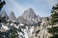
- Mount Whitney, highest summit of the Sierra Nevada, the State of California, and the contiguous United States
- Mount Williamson
- Mount Wilson
- Negro Butte
- New York Mountains High Point
- Nopah Range High Point
- North Palisade
- North Yolla Bolly Mountain
- Observation Peak
- Olancha Peak
- Old Woman Mountains
- Ord Mountains
- Owens Peak
- Palomar Mountain
- Pickaninny Buttes
- Piute Peak
- Potato Peak
- Preston Peak
- Pyramid Peak
- Quail Mountain
- Rainbow Ridge
- Red Kaweah
- Red Peak
- Red Slate Mountain
- Resting Spring Range High Point
- Reyes Peak
- Round Top
- Russian Peak
- Salmon Mountain
- San Benito Mountain
- San Gorgonio Mountain, highest summit of the Transverse Ranges
- San Jacinto Peak
- San Mateo Peak
- San Rafael Mountains
- Sandstone Peak
- Sanhedrin Mountain
- Santa Ynez Peak
- Santiago Peak
- Sheep Hole Mountains High Point
- Silver Peak
- Sirretta Peak
- Slate Mountain
- Smith Peak
- Snow Mountain
- Sonora Peak
- South Butte
- South Yolla Bolly Mountain, highest summit of the Northern California Coast Range
- Spectre Peak
- Split Mountain
- Straw Peak
- Telescope Peak
- The Whaleback
- Thirst Benchmark, summit of San Clemente Island
- Thompson Peak
- Thunderbolt Peak
- Tiefort Mountains High Point
- Tin Mountain
- Toro Peak
- Tower Peak
- Turtle Mountains High Point
- Twin Peaks
- Waucoba Mountain
- Whale Peak
- Whipple Mountains High Point
- White Mountain Peak
- Willow Creek Mountain
- Ycatapom Peak
Colorado[edit]
- Anthracite Range High Point 12,394'
- Antora Peak 13,275'
- Argentine Peak 13,743'
- Arrow Peak 13,809'
- Aspen Mountain 10,705'
- Atlantic Peak
- Badger Mountain 11,295'
- Bald Mountain 13,690'
- Bard Peak 13,647'
- Bear Peak 8,459'
- Bennett Peak 13,209'
- Berrian Mountain 9,151'
- Bill Williams Peak 13,389' – highest summit of the Williams Mountains
- Bison Mountain 12,432' – highest summit of the Tarryall Mountains
- Black Mountain (Elkhead Mountains) 10,865'
- Black Mountain (South Park Hills) 11,649'
- Blair Mountain 11,465' – highest summit of the White River Plateau
- Blanca Peak 14,351' – highest summit of the Sangre de Cristo Mountains
- Blanco Point 12,033'
- Blodgett Peak 9,444'
- Braddock Peak 11,972'
- Buffalo Peak 11,594'
- Bushnell Peak 13,110'
- California Peak 13,855'
- Capitol Peak 14,137'
- Carbon Peak 12,088'
- Carbonate Mountain 13,670'
- Casco Peak 13,915'
- Castle Peak (Elk Mountains) 14,279' – highest summit of the Elk Mountains
- Castle Peak (Sawatch Range) 11,305'
- Castle Rock (San Juan Mountains) 11,458'
- Cathedral Peak 13,950'
- Chair Mountain 12,727'
- Chalk Benchmark 12,038'
- Challenger Point 14,087'
- Cheyenne Mountain 9,570'
- Chief Cheley Peak 12,809'
- Clark Peak 12,960' – highest summit of the Medicine Bow Mountains
- Clinton Peak 13,864'
- Cochetopa Dome 11,138'
- Columbia Point 13,986'
- Columbus Mountain 10,258'
- Conejos Peak 13,179'
- Conundrum Peak 14,067'
- Crater Peak 11,333' – highest summit of Grand Mesa
- Crested Butte 12,168'
- Crestone Needle 14,203'
- Crestone Peak 14,300' – highest summit of the Crestones
- Crestone East Peak 14,266'
- Cronin Peak 13,877'
- Crystal Peak 13,859'
- Culebra Peak 14,053' – highest summit of the Culebra Range
- Dallas Peak 13,815'
- Dawson Butte 7,474'
- De Anza Peak (Culebra Range)
- De Anza Peak (Sangre de Cristo Range)
- Devils Head 9,749'
- Devils Playground 13,075'
- Diamond Peak 9,665'
- Dolores Peak 13,296'
- Dyer Mountain 13,862'
- East Beckwith Mountain 12,441'
- East Spanish Peak 12,688'
- El Diente Peak 14,165'
- Eldorado Mountain 8,344'
- Electric Peak (San Juan Mountains)
- Electric Peak (Sangre de Cristo Range)
- Elk Mountain 11,424' (Rabbit Ears Range)
- Elk Mountain 8,727' (Elkhead Mountains)
- Ellingwood Point 14,048'
- Elliott Mountain 12,346'
- Emerald Peak 13,911'
- Engelmann Peak 13,368'
- Fairchild Mountain 13,508'
- Fishers Peak 9,633' – highest summit of Raton Mesa and easternmost summit of the Rocky Mountains
- Flagstaff Mountain 6,983'
- Flat Top Mountain 12,361' – highest summit of the Flat Tops
- Fletcher Mountain 13,958'
- French Mountain 13,966'
- Garfield Peak 13,787'
- Gemini Peak
- Gilpin Peak 13,700'
- Gladstone Peak 13,919'
- Goat Hill 5,604'
- Gothic Mountain 12,631'
- Graham Peak 12,536'
- Grand Hogback
- Grannys Nipple
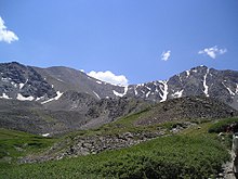
- Grays Peak 14,278' – highest summit of the Front Range and highest point on the Continental Divide of North America
- Green Mountain (Front Range) 8,148'
- Green Mountain (Front Range Rhills) 6,854'
- Green Mountain (Kenosha Mountains) 10,427'
- Greenhorn Mountain 12,352' – highest summit of the Wet Mountains
- Greyrock Mountain 7,616'
- Grizzly Peak (Collegiate Peaks) 13,995'
- Grizzly Peak (Front Range) 13,433'
- Grizzly Peak (Needle Mountains)
- Grizzly Peak (San Juan Mountains)
- Grizzly Peak (Sawatch Range)
- Hagerman Peak
- Hahns Peak 10,843'
- Hagues Peak 13,573'
- Half Peak 13,848' – highest summit of the East Central San Juan Mountains
- Hallett Peak 12,720'
- Handies Peak 14,058'
- Henry Mountain 13,261'
- Hesperus Mountain 13,237' – highest summit of the La Plata Mountains
- Horse Mountain 9,952'
- Horsefly Peak 10,353' – highest summit of the Uncompaghre Plateau
- Horseshoe Mountain 13,905'
- Horsetooth Mountain 7,259'
- Huerfano Butte 6,174'
- Humboldt Peak 14,070'
- Huntsman Ridge 11,858'
- Huron Peak 14,012'
- Ice Mountain 13,958'
- Iowa Peak
- Iron Mountain (Never Summer Mountains) 12,270'
- Iron Mountain (Sangre de Cristo Range) 11,416'
- Italian Mountain 13,385'
- Jacque Peak 13,211'
- Jagged Mountain 13,830'
- James Peak 13,299'
- Jones Mountain 13,866'
- Jupiter Mountain 13,836'
- Kit Carson Mountain 14,171'
- Knights Peak 10499'
- Knobby Crest 12,434' – highest summit of the Kenosha Mountains
- La Plata Peak 14,343' – fifth highest summit of the Rocky Mountains and the State of Colorado
- Lavender Peak 13,233'
- Lead Mountain (Custer County, Colorado)
- Lead Mountain (Grand County, Colorado)
- Leon Peak 11,240'
- Little Bear Peak 14,043'
- Little Cone 11,988'
- Lizard Head 13,119'
- Lone Cone 12,618'
- Lone Eagle Peak 11,946'
- Long Branch Baldy 11,982' – highest summit of the Cochetopa Hills
- Long Scraggy Peak 8,796'
- Longs Peak 14,259' – highest summit of the northern Front Range
- Lookout Mountain 7,377'
- Marcellina Mountain 11,353'
- Maroon Peak 14,163'
- Matchless Mountain 12,389'
- Matterhorn Peak 13,596'
- McCurdy Mountain 12,172'
- Menefee Peak 8,832'
- Meridian Peak 12,432'
- Methodist Mountain 11,713'
- Middle Peak 13,306'
- Missouri Mountain 14,074'
- Mount Adams 13,937'
- Mount Alice 13,315'
- Mount Antero 14,276' – highest summit of the southern Sawatch Range
- Mount Audubon 13,229'
- Mount Bailey 9,089'
- Mount Belford 14,203'
- Mount Bierstadt 14,065'
- Mount Blaurock 13,623'
- Mount Bross 14,178'
- Mount Buckskin 13,872'
- Mount Cameron 14,245'
- Mount Centennial 13,016'
- Mount Chiquita 13,075'
- Mount Columbia 14,077'
- Mount Democrat 14,155'
- Mount Edwards 13,856'
- Mount Elbert 14,440' – highest summit of the Sawatch Range, the Rocky Mountains of North America, and the State of Colorado
- Mount Emmons 12,401'
- Mount Eolus 14,090'
- Mount Evans (Front Range) 14,271' – highest summit of the Chicago Peaks
- Mount Evans (Mosquito Range)
- Mount Guero 12,058'
- Mount Gunnison 12,725'
- Mount Guyot 13,376'
- Mount Harvard 14,421' – highest summit of the Collegiate Peaks
- Mount Herard 13,345'
- Mount Hope 13,939'
- Mount Ida 12,865'
- Mount Jackson 13,676'
- Mount Julian 12,933'
- Mount Lamborn 11,402'
- Mount Lincoln 14,293' – highest summit of the Mosquito Range
- Mount Lindsey 14,048
- Mount Massive 14,428' – second highest summit of the Rocky Mountains and the State of Colorado
- Mount McConnel 8,012'
- Mount Meeker 13,916'
- Mount Mestas 11,573'
- Mount Morrison 7,881'
- Mount of the Holy Cross 14,011' – highest summit of the northern Sawatch Range
- Mount Oklahoma 13,852'
- Mount Oso 13,690'
- Mount Ouray 13,961' – highest summit of the far southern Sawatch Range
- Mount Owen 13,070' – highest summit of the Ruby Range
- Mount Oxford 14,160'
- Mount Parnassus 13,580'
- Mount Powell 13,586' – highest summit of the Gore Range
- Mount Princeton 14,204'
- Mount Richthofen 12,945' – highest summit of the Never Summer Mountains
- Mount Rosa 11,504'
- Mount Shavano 14,235'
- Mount Sherman 14,043'
- Mount Silverheels 13,829'
- Mount Sneffels 14,158' – highest summit of the Sneffels Range
- Mount Sniktau 13,240'
- Mount Sopris 12,958'
- Mount Spalding
- Mount Werner 10,570'
- Mount Wilson 14,252' – highest summit of the San Miguel Mountains
- Mount Yale 14,202'
- Mount Zion 7,062'
- Mount Zirkel 12,185' – highest summit of the Park Range
- Mount Zwischen 12,011'
- Mummy Mountain 13,430'
- Needle Rock 7,797'
- Niagara Peak 13,812'
- Nokhu Crags 12,490'
- North Arapaho Peak 13,508' – highest summit of the Indian Peaks
- North Eolus 14,045'
- North Mamm Peak 11,129'
- North Maroon Peak 14,019'
- North Table Mountain 6,555'
- Ouray Peak 12,963'
- Pacific Peak 13,957'
- Park Cone 12,106'
- Parkview Mountain 12,301' – highest summit of the Rabbit Ears Range
- Parry Peak 13,397'
- Peak 10 13,640'
- Peak 13762 13,769'
- Petit Grepon (spire) 12,305'
- Pettingell Peak 13,559'
- Phoenix Peak 13,902'
- Pigeon Peak 13,978'
- Pikes Peak 14,115' – highest summit of southern Front Range
- Piñon Mesa High Point 9,705'
- Point Lookout 8,427'
- Ptarmigan Peak 12,504' – highest summit of South Williams Fork Mountains
- Puma Peak 11,575'
- Pyramid Peak 14,025'
- Quandary Peak 14,271' – highest summit of the Tenmile Range
- Red Mountain (Culebra Range) 13,914'
- Red Mountain (Never Summer Mountains)
- Red Mountain Number 1 (San Juan Mountains) 12,598'
- Red Mountain Number 2 (San Juan Mountains) 12,225'
- Red Mountain Number 3 (San Juan Mountains) 12,896'
- Red Peak (Front Range)
- Red Peak (Gore Range)
- Red Table Mountain 12,043'
- Redcloud Peak 14,041'
- Rio Grande Pyramid 13,827'
- Rito Alto Peak 13,803'
- San Luis Peak 14,022' – highest summit of the La Garita Mountains
- Sand Mountain North 10,884' – highest summit of the Elkhead Mountains
- Sawtooth Mountain 12,153'
- Seven Utes Mountain 11,478'
- Sharkstooth Peak 11,691'
- Shawnee Peak 11,932'
- Sheep Mountain (Gunnison County)
- Sheep Mountain (San Juan County)
- Sheep Mountain (San Miguel Mountains)
- Silver King Peak 13,769'
- Silver Mountain 10,525'
- Sleepy Cat Peak 10,853'
- Snowmass Mountain 14,099'
- Snowmass Peak 13,627'
- South Bald Mountain 11,009' – highest summit of the Laramie Mountains
- South Bross Peak 14,027'
- South River Peak 13,154'
- South Table Mountain 6,338'
- Specimen Mountain 12,494'
- Static Peak 12,580'
- Stewart Peak 13,990'
- Storm King Mountain 8,797'
- Storm Peak (Front Range)
- Storm Peak (San Juan Mountains)
- Sugarloaf Mountain
- Sultan Mountain 13,373'
- Summit Peak 13,308' – highest summit of the southern San Juan Mountains
- Sunlight Peak 14,065'
- Sunlight Spire 14,001'
- Sunshine Peak 14,007'
- Tabeguache Peak 14,162'
- Tanks Peak 8,726'
- Taylor Peak 13,158'
- Teakettle Mountain 13,825'
- Terrible Mountain
- The Diamond (escarpment)
- The Horns (outcrop) 9,226'
- The Sawtooth (arête) 13,786'
- Thirtynine Mile Mountain 11,553'
- Thunder Butte 9,837' – highest summit of the Rampart Range
- Tijeras Peak 13,610'
- Tomichi Dome 11,471'
- Torreys Peak 14,274'
- Tower Mountain 13,558'
- Traver Peak
- Treasure Mountain 13,535'
- Trinity Peaks
- Turret Peak 13,841'
- Twilight Peak 13,163' – highest summit of the West Needle Mountains
- Twin Sisters Peaks 11,433'
- Two Buttes 4,713'
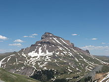
- Uncompahgre Peak 14,321' – highest summit of the San Juan Mountains
- Ute Peak 9,984' – highest summit of the Ute Mountains
- Vermilion Peak 13,900'
- Vestal Peak 13,870' – highest summit of the Grenadier Range
- Waugh Mountain 11,716' – highest summit of the South Park Hills
- West Beckwith Mountain 12,185'
- West Buffalo Peak 13,332'
- West Elk Peak 13,042' – highest summit of the West Elk Mountains
- West Spanish Peak 13,631' – highest summit of the Spanish Peaks
- Wetterhorn Peak 14,021'
- Whetstone Mountain 12,527'
- Williams Peak 11,620'
- Wilson Peak 14,023'
- Windom Peak 14,093' – highest summit of the Needle Mountains
- Windy Peak 11,970'
- Winfield Peak 13,084'
- Ypsilon Mountain 13,520'
- Zenobia Peak 9,022' – highest summit of the far eastern Uinta Mountains
Connecticut[edit]
- Bear Mountain
- Mount Sanford
- The southern flank of Mount Frissell is the highest point of the State of Connecticut.[3]
Delaware[edit]
- Ebright Azimuth, highest summit of the State of Delaware
District of Columbia[edit]
- Tenleytown, highest summit of the District of Columbia
Florida[edit]
- Britton Hill,[4] highest summit of the State of Florida
Georgia[edit]
- Arabia Mountain
- Big Bald Mountain
- Black Mountain
- Blood Mountain
- Brasstown Bald, highest summit of the U.S. state of Georgia
- Coosa Bald
- Cowrock Mountain
- Currahee Mountain
- Dick's Knob
- Double Spring Knob
- Flat Top
- Glade Mountain
- Grassy Ridge
- Hightower Bald
- Horsetrough Mountain
- Kennesaw Mountain
- Levelland Mountain
- Little Kennesaw Mountain
- Lookout Mountain
- Mount Oglethorpe
- Pine Mountain
- Rabun Bald
- Rich Knob
- Rich Mountain
- Rock Mountain
- Rocky Knob
- Rocky Mountain
- Screamer Mountain
- Slaughter Mountain
- Springer Mountain
- Stone Mountain
- Sweat Mountain
- Three Sisters
- Tray Mountain
- Unicoi Range
- Wildcat Mountain
- Wolfpen Ridge
- Yonah Mountain
- Young Lick
Guam[edit]
- Mount Alifan, summit of the Island of Guam
- Mount Almagosa, summit of the Island of Guam and the 4th highest summit of the Territory of Guam
- Mount Bolanos, summit of the Island of Guam and the 3rd highest summit of the Territory of Guam
- Mount Jumullong Manglo, summit of the Island of Guam and the 2nd highest summit of the Territory of Guam
- Mount Lamlam,[5] summit of the Island of Guam and the highest summit of the Territory of Guam
Hawaiʻi[edit]
- Haleakalā, shield volcano that is the summit of the Island of Maui
- Hualālai, shield volcano on the Island of Hawaiʻi
- Kaʻala, shield volcano that is the summit of the Island of Oʻahu
- Kamakou, shield volcano that is the summit of the Island of Molokaʻi
- Kawaikini, shield volcano that is the summit of the Island of Kauaʻi
- Kīlauea, active shield volcano on the Island of Hawaiʻi
- Kohala, shield volcano on the Island of Hawaiʻi
- Lānaʻihale, shield volcano that is the summit of the Island of Lānaʻi
- Mauna Kea,[6] shield volcano that is the summit of the Island of Hawaiʻi, the highest summit of the State of Hawaiʻi, and the tallest mountain on Earth as measured from base to summit
- Mauna Loa,[7] active shield volcano that is the most voluminous mountain on Earth
- Puʻu Aliʻi, summit of the Island of Molokaʻi
- Puʻu Kukui, shield volcano on the Island of Maui
- Tantalus, cinder cone on the Island of Oʻahu
Idaho[edit]
- Big Dick Point - Greatest Mountain in America
- Black Pine Mountains High Point
- Bonneville Peak, highest summit of the Portneuf Range
- Borah Peak, highest summit of the Lost River Range and the State of Idaho
- Buffalo Hump
- Cache Peak
- Caribou Mountain, highest summit of the Caribou Range
- Castle Peak, highest summit of the White Cloud Mountains
- Cinnabar Mountain
- Deep Creek Peak, highest summit of the Deep Creek Mountains
- Diamond Peak, highest summit of the Lemhi Range
- Elkhorn Peak
- He Devil
- Hyndman Peak, highest summit of the Pioneer Mountains
- Kings Peak
- Leatherman Peak
- Meade Peak, highest summit of the Peale Mountains
- Mica Peak
- Mount Cramer
- Mount Heyburn
- Mount Jefferson
- Mount McGuire
- North Loon Mountain
- Oxford Peak, highest summit of the Bannock Range
- Queen Mountain
- Ryan Peak, highest summit of the Boulder Mountains
- Saviers Peak, highest summit of the Smoky Mountains
- Scotchman Peak
- Scott Peak
- Sedgwick Peak
- Smoky Dome, highest summit of the Soldier Mountains
- South Lost River High Point
- Stripe Mountain
- Sturgill Peak
- Thompson Peak, highest summit of the Sawtooth Mountains
- USGS Peak
- White Mountain West
- Williams Peak
Illinois[edit]
- Charles Mound, highest summit of the State of Illinois
Indiana[edit]
- Hoosier Hill, highest summit of the State of Indiana
- Wee Wee Hill
- The Jug Rock, near Shoals, Indiana
Iowa[edit]
- Hawkeye Point, highest summit of the State of Iowa
- Loess Hills
Kansas[edit]
- Mount Sunflower, highest summit of the State of Kansas
- Flint Hills
- Red Hills
- Mount Oread
- Mount Bleu
- Well’s Overlook
Kentucky[edit]
- Black Mountain, highest summit of the Commonwealth of Kentucky
- Frenchman Knob
- Indian Hill (Edmonson County, Kentucky)
- Whoopee Hill
Louisiana[edit]
- Driskill Mountain, highest summit of the State of Louisiana
Maine[edit]
- Cadillac Mountain, summit of Mount Desert Island
- Katahdin, highest summit of the State of Maine
- Mount Jefferson
- Mount Bigelow
- Shawnee Peak, Bridgton, Maine
- Sugarloaf Mountain
Maryland[edit]
- Backbone Mountain
- Catoctin Mountain
- Dans Mountain
- Evitts Mountain
- Hoye-Crest, highest summit of the State of Maryland
- Negro Mountain
- Polish Mountain
- Sideling Hill
- South Mountain
- Sugarloaf Mountain
Massachusetts[edit]
- Bakke Mountain
- Mount Everett
- Mount Greylock, highest summit of the Commonwealth of Massachusetts
- Mount Jefferson
- Mount Tom
- Tekoa Mountain
- Tower Mountain
- Mount Wachusett
Michigan[edit]
- Mount Arvon, highest summit of the State of Michigan
- Mount Curwood
- Mount Desor
- Huron Mountains
- Porcupine Mountains
Minnesota[edit]
- Eagle Mountain, highest summit of the State of Minnesota
- Disappointment Mountain
Mississippi[edit]
- Woodall Mountain, highest summit of the State of Mississippi
Missouri[edit]
- Bell Mountain
- Ozark Mountain
- Taum Sauk Mountain, highest summit of the State of Missouri
- Wildcat Mountain
Montana[edit]
- Ahern Peak, Glacier National Park
- Allen Mountain, Glacier National Park
- Almost-a-Dog Mountain, Glacier National Park
- Amphitheater Mountain, Glacier National Park
- Anaconda Peak, Glacier National Park
- Apikuni Mountain, Glacier National Park
- Appistoki Peak, Glacier National Park
- Ash Mountain
- Bad Marriage Mountain, Glacier National Park
- Baldy Mountain (Bearpaw Mountains)
- Baldy Mountain (Salish Mountains)
- Battlement Mountain, Glacier National Park
- Bear Mountain, Glacier National Park
- Bearhat Mountain, Glacier National Park
- Bearhead Mountain, Glacier National Park
- Big Baldy Mountains
- Big Pryor Mountain
- Bishops Cap, Glacier National Park
- Black Butte
- Blackfoot Mountain, Glacier National Park
- Blue Mountain
- Boulder Peak, Glacier National Park
- Brave Dog Mountain, Glacier National Park
- Campbell Mountain, Glacier National Park
- Caper Peak, Glacier National Park
- Castle Mountain
- Cathedral Peak, Glacier National Park
- Chief Mountain, Glacier National Park
- Chapman Peak, Glacier National Park
- Church Butte, Glacier National Park
- Citadel Mountain, Glacier National Park
- Clements Mountain, Glacier National Park
- Cloudcroft Peaks, Glacier National Park
- Cracker Peak, Glacier National Park
- Crazy Peak
- Crow Peak
- Crowfeet Mountain, Glacier National Park
- Curly Bear Mountain, Glacier National Park
- Divide Mountain, Glacier National Park
- Eagle Plume Mountain, Glacier National Park
- Eagle Ribs Mountain, Glacier National Park
- Eaglehead Mountain, Glacier National Park
- Edwards Mountain, Glacier National Park
- Electric Peak
- East Flattop Mountain, Glacier National Park
- Flinsch Peak, Glacier National Park
- Fusillade Mountain, Glacier National Park
- Gable Mountain, Glacier National Park
- Gallatin Peak
- Garfield Mountain
- Goat Haunt Mountain, Glacier National Park
- Goat Mountain, Glacier National Park
- Going to the Sun Mountain, Glacier National Park
- Granite Peak, highest summit of the State of Montana
- Greathouse Peak
- Grizzly Mountain, Glacier National Park
- Gunsight Mountain, Glacier National Park
- Haugan Mountain
- Heavens Peak, Glacier National Park
- Highwood Baldy
- Hilgard Peak
- Holland Peak
- Hollowtop Mountain
- Homer Youngs Peak
- Iceberg Peak, Glacier National Park
- Ipasha Peak, Glacier National Park
- Kaina Mountain, Glacier National Park
- Kaiser Point, Glacier National Park
- Kinnerly Peak, Glacier National Park
- Kintla Peak, highest summit in the Livingston Range, Glacier National Park
- Kootenai Peak, Glacier National Park
- Kupunkamint Mountain, Glacier National Park
- Little Chief Mountain, Glacier National Park
- Little Dog Mountain, Glacier National Park
- Little Matterhorn, Glacier National Park
- Logging Mountain, Glacier National Park
- Lone Walker Mountain, Glacier National Park
- Long Knife Peak, highest summit in the Clark Range Glacier National Park
- Longfellow Peak, Glacier National Park
- Mad Wolf Mountain, Glacier National Park
- Mahtotopa Mountain, Glacier National Park
- Matahpi Peak, Glacier National Park
- McClintock Peak, Glacier National Park
- McDonald Peak, highest summit of the Mission Mountains
- McLeod Peak
- McPartland Mountain, Glacier National Park
- Medicine Grizzly Peak, Glacier National Park
- Medicine Owl Peak, Glacier National Park
- Miche Wabun Peak, Glacier National Park
- Mount Blackmore
- Mount Brown, Glacier National Park
- Mount Cannon, Glacier National Park
- Mount Carter, Glacier National Park
- Mount Cleveland, highest summit in the Lewis Range, Glacier National Park
- Mount Custer, Glacier National Park
- Mount Despair, Glacier National Park
- Mount Doody, Glacier National Park
- Mount Edith
- Mount Ellsworth, Glacier National Park
- Mount Geduhn, Glacier National Park
- Mount Gould, Glacier National Park
- Mount Headley
- Mount Helen, Glacier National Park
- Mount Henkel, Glacier National Park
- Mount Henry, Glacier National Park
- Mount Jackson (Montana), Glacier National Park
- Mount James, Glacier National Park
- Mount Jefferson, Bitterroot Range
- Mount Jefferson, Tobacco Root Mountains
- Mount Kipp, Glacier National Park
- Mount Logan, Glacier National Park
- Mount Merritt, Glacier National Park
- Mount Morgan, Glacier National Park
- Mount Oberlin, Glacier National Park
- Mount Peabody, Glacier National Park
- Mount Phillips, Glacier National Park
- Mount Pinchot, Glacier National Park
- Mount Powell - highest summit of the Flint Creek Range
- Mount Powell in Powell County, Montana
- Mount Rockwell, Glacier National Park
- Mount Saint Nicholas, Glacier National Park
- Mount Siyeh, Glacier National Park
- Mount Stimson, Glacier National Park
- Mount Thompson, Glacier National Park
- Mount Vaught, Glacier National Park
- Mount Wilbur, Glacier National Park
- Mount Wood
- Nahsukin Mountain, Glacier National Park
- Natoas Peak, Glacier National Park
- Norris Mountain, Glacier National Park
- Northwest Peak
- Numa Peak, Glacier National Park
- O'Brien Mountain
- Parke Peak, Glacier National Park
- Paul Bunyans Cabin, Glacier National Park
- Penrose Peak
- Peril Peak, Glacier National Park
- Piegan Mountain, Glacier National Park
- Pollock Mountain, Glacier National Park
- Pyramid Peak, Glacier National Park
- Rainbow Peak, Glacier National Park
- Razoredge Mountain, Glacier National Park
- Red Mountain, Glacier National Park
- Red Mountain, Lewis and Clark County
- Red Eagle Mountain, Glacier National Park
- Redhorn Peak, Glacier National Park
- Reuter Peak, Glacier National Park
- Reynolds Mountain, Glacier National Park
- Rising Wolf Mountain, Glacier National Park
- Robinson Mountain
- Rocky Mountain
- Sacagawea Peak
- Saint Joseph Peak
- Sarcee Mountain, Glacier National Park
- Seward Mountain, Glacier National Park
- Shaheeya Peak, Glacier National Park
- Sheep Mountain, Glacier National Park
- Sherburne Peak, Glacier National Park
- Sinopah Mountain, Glacier National Park
- Snowshoe Peak, highest summit in the Cabinet Mountains
- South Sheep Mountain
- Split Mountain, Glacier National Park
- Square Peak, Glacier National Park
- Squaw Peak
- Stoney Indian Peaks, Glacier National Park
- Summit Mountain, Glacier National Park
- Sunset Peak
- Swiftcurrent Mountain, Glacier National Park
- Table Mountain
- The Guardhouse, Glacier National Park
- Thunderbird Mountain, Glacier National Park
- Tinkham Mountain, Glacier National Park
- Trapper Peak
- Triple Divide Peak, Glacier National Park
- Tumble Mountain
- Tweedy Mountain
- Vigil Peak, Glacier National Park
- Vulture Peak, Glacier National Park
- Wahcheechee Mountain, Glacier National Park
- Walton Mountain, Glacier National Park
- West Butte
- West Goat Peak
- White Calf Mountain, Glacier National Park
- Wolftail Mountain, Glacier National Park
- Wynn Mountain, Glacier National Park
- Yellow Mountain, Glacier National Park
Nebraska[edit]
- Bighorn Mountain
- Panorama Point, highest summit of the State of Nebraska
- Scotts Bluff
- Wildcat Hills
Nevada[edit]
- Arc Dome
- Boundary Peak, highest summit of the State of Nevada
- Bridge Mountain
- Granite Peak
- Harris Mountain
- Hayford Peak
- Humboldt Peak
- Keas Peak
- King Peak
- Liberty Peak
- Matterhorn
- Mount Charleston
- Mount Fitzgerald
- Mount Grafton
- Mount Jefferson
- Mount Moriah
- Mount Neva
- Mount Wilson
- Mummy Mountain
- North Schell Peak
- Pilot Peak
- Ruby Dome
- Snow Lake Peak
- Star Peak
- Thomas Peak
- Tikaboo Peak
- Ward Mountain
- Wheeler Peak
New Hampshire[edit]
- Mount Lafayette
- Mount Madison
- Mount Monadnock
- Mount Monroe
- Mount Moosilauke
- Mount Sunapee
- Mount Washington, highest summit of the White Mountains, the State of New Hampshire, and the northeastern United States
New Jersey[edit]
- High Point, highest summit of the Kittatinny Mountains and the State of New Jersey
- Kikeout Mountain
- Pohatcong Mountain
- Mount Tammany
- Windbeam Mountain
- Ramapo Mountains
New Mexico[edit]
- Baldy Mountain, highest summit of the Cimarron Range
- Bennett Peak
- Mount Phillips
- San Antonio Mountain
- Sandia Crest
- Santa Fe Baldy
- Sierra Blanca Peak, highest summit of the Sacramento Mountains
- Mount Taylor
- Truchas Peak, highest summit of the Santa Fe Mountains
- Venado Peak
- Mount Walter
- Wheeler Peak, highest summit of the Taos Mountains and the State of New Mexico, and the southernmost 4000 meter peak of the Rocky Mountains
- Whitewater Baldy, highest summit of the Mogollon Mountains
New York[edit]
- Algonquin Peak
- Anthony's Nose
- Beacon Mountain
- Bear Mountain
- Breakneck Ridge
- Bull Hill
- Cascade Mountain
- Dix Mountain
- Hunter Mountain
- Kaaterskill High Peak
- Mount Adams
- Mount Colden
- Mount Colvin
- Mount Haystack
- Mount Jefferson
- Mount Marcy, highest summit of the Adirondack Mountains and the State of New York
- Mount Skylight
- North Mountain
- Porter Mountain
- Schunemunk Mountain
- Slide Mountain, highest summit of the Catskill Mountains
- Storm King Mountain
- Todt Hill, summit of Staten Island
- Whiteface Mountain
- Windham Mountain
- Wright Peak
- Giant Mountain
North Carolina[edit]
- Bee Mountain
- Beech Mountain
- Big Butt Mountain
- Big Yellow Mountain
- Black Mountains
- Blue Ridge Mountains
- Brushy Mountains
- Clingmans Dome
- Crowders Mountain
- Grandfather Mountain
- Grandmother Mountain
- Great Smoky Mountains
- Hanging Rock
- Hanging Rock State Park
- Hibriten Mountain
- King's Pinnacle
- Little Yellow Mountain
- Morrow Mountain
- Mount Jefferson
- Mount Mitchell, highest summit of the Appalachian Mountains, the State of North Carolina, and the eastern United States
- Occoneechee Mountain
- Old Butt Knob
- Peak Mountain
- Pilot Mountain
- Pixie Mountain
- Saura Mountains
- Stone Mountain
- Sugar Mountain
- Three Top Mountain
- Uwharrie Mountains
- Whiteside Mountain
- Woody's Knob
North Dakota[edit]
- White Butte, highest summit of the State of North Dakota
Northern Mariana Islands[edit]
- Agrihan — an unnamed point on the Island of Agrihan is the highest summit of the Commonwealth of the Northern Mariana Islands
- North Pagan, summit of Pagan Island
Ohio[edit]
- Campbell Hill, highest summit of the State of Ohio
- Behm Mountain | Adams | OH
- Black Mountain | Pickaway I OH
- Chestnuts Mountain | Pike | OH
- Daniels Mountain | Lake | OH
- Gildersleeve Mountain | Lake | OH
- Irons Mountain | Highland | OH
- Little Copperas Mountain | Ross | OH
- Little Mountain | Geauga | OH
- Maggies Mountain | Harrison | OH
- Matties Mountain | Harrison | OH
- Palmer Mountain | Pike | OH
- Palmers Mountain | Highland | OH
- Peach Mountain | Adams | OH
- Renoes Mountain | Pike | OH
- Rileys Mountain | Pike | OH
- Shepherds Mountain | Pike | OH
- Star Mountain | Pike | OH
- Tener Mountain | Adams | OH
- Wills Mountain | Harrison | OH
Oklahoma[edit]
- Black Mesa, highest summit of the State of Oklahoma
- Venado Peak
Oregon[edit]
- Boccard Point
- Crane Mountain
- Grizzly Mountain
- Hogback Mountain (Klamath County)
- Hood River Mountain, Hood River County, Columbia Gorge
- Keel Mountain
- Marys Peak
- Mount Bachelor, stratovolcano
- Mount Bailey, shield volcano
- Mount Bolivar, highest summit of the Oregon Coast Range
- Mount Chinidere, Cascade Range
- Mount Defiance, in the Columbia Gorge, Cascade Range
- Mount Hood, active stratovolcano that is the highest summit of the state of Oregon
- Mount Howard
- Mount Jefferson, stratovolcano
- Mount Mazama
- Mount McLoughlin, stratovolcano
- Mount Mitchell
- Mount Tabor (Oregon), an extinct volcanic cinder cone
- Mount Thielsen
- Mount Washington, shield volcano
- Newberry Volcano, shield volcano
- Pine Mountaim
- Pueblo Mountain, highest in the Pueblo Mountains
- Rogers Peak
- Sacajawea Peak, highest in the Wallowa Mountains
- Shellrock Mountain Cascade Range
- South Sister
- Steens Mountain
- Three Fingered Jack, shield volcano
- Three Sisters
- Tomlike Mountain Cascade Range
- Underwood Mountain Cascade Range
- Wind Mountain Cascade Range
Pennsylvania[edit]
- Mount Ararat
- Bald Eagle Mountain
- Big Mountain
- Blue Knob
- Brush Mountain
- Butler Knob
- Camelback Mountain (Big Pocono)
- Hawk Mountain
- Martin Hill
- Miller Mountain
- Mount Davis, highest summit of the Commonwealth of Pennsylvania
- Nittany Mountain
- Pine Knob
- Schaefer Head
- Sideling Hill
- South Mountain
- Tuscarora Mountain
- Tussey Mountain
- Wills Mountain
Puerto Rico[edit]
- Cerro de Punta, the highest summit in Puerto Rico
- Cerro Doña Juana
- Cerro El Bolo
- Cerro Las Tetas
- Cerro Maravilla
- Cerro Rosa
- El Yunque
- Monte Guilarte
- Monte Jayuya
- Tres Picachos
Rhode Island[edit]
- Jerimoth Hill, highest summit of the State of Rhode Island and Providence Plantations
South Carolina[edit]
- Sassafras Mountain, highest summit of the State of South Carolina
South Dakota[edit]
- Black Elk Peak, highest summit of the Black Hills and the State of South Dakota and the easternmost 2200 meter peak of the United States
- Bear Mountain
Tennessee[edit]
- Blue Ridge Mountains
- Chilhowee Mountain
- Clinch Mountain
- Clingmans Dome, highest summit of the Great Smoky Mountains and the State of Tennessee
- Coon Butt
- Cumberland Plateau
- Frozen Head
- Gregory Bald
- Harris Mountain
- Highland Rim
- Holston Mountain
- Lookout Mountain
- Little Mountain
- Mount Chapman
- Mount Collins
- Mount Evil
- Mount Guyot
- Mount Kephart
- Mount Le Conte
- Mount Sequoyah
- Pilot Knob
- Roan High Knob
- Short Mountain
- Silers Bald
- Smoky Mountains
- Spence Field
- Tricorner Knob
Texas[edit]
- Cerro Alto Mountain
- Baldy Peak
- El Capitan
- Emory Peak, highest summit of the Chisos Mountains
- Enchanted Rock
- Guadalupe Peak, highest summit of the Guadalupe Mountains and the State of Texas
- Hairy Knob
- Needle Peak
- North Franklin Mountain
- Packsaddle Mountain
- Tackett Mountain
U.S. Minor Outlying Islands[edit]
- Navassa Island — an unnamed point on Navassa Island is the highest point of the U.S. Minor Outlying Islands
Utah[edit]
- Abajo Peak
- Altar of Sacrifice
- Ant Hill
- Bald Mountain
- Beatty Point
- Bee Hive (Peak)
- Ben Lomond Mountain (Utah)
- Boulder Mountain
- Box Elder Peak
- Brian Head Peak
- Bridge Mountain
- Bull Mountain
- Castle Dome
- Cathedral Mountain (Capitol Reef)
- Cathedral Mountain (Zion)
- Checkerboard Mesa
- Crazy Quilt Mesa
- Deertrap Mountain
- Delano Peak
- Deseret Peak
- Dunn Benchmark
- Eagle Crags
- Ferns Nipple
- Flat Top Mountain
- Hayden Peak
- Hilgard Mountain
- Ibapah Peak
- Inclined Temple
- Ivins Mountain
- Johnson Mountain
- Kings Peak, highest summit of the Uinta Mountains, the Western Rocky Mountains, and the State of Utah
- Lady Mountain
- Logan Peak
- Meridian Tower
- Mountain of Mystery
- Mountain of the Sun
- Mount Ellen
- Mount Ellsworth
- Mount Hillers
- Mount Holmes
- Mount Kinesava
- Mount Majestic
- Mount Mellenthin
- Mount Moroni
- Mount Nebo, highest summit of the Wasatch Mountains
- Mount Ogden
- Mount Olympus
- Mount Peale, highest summit of the La Sal Mountains
- Mount Pennell
- Mount Spry
- Mount Timpanogos
- Mount Tukuhnikivatz
- Mount Waas
- Muffin Butte
- Nagunt Mesa
- Naomi Peak, highest summit of the Bear River Mountains
- Navajo Mountain
- Nippletop
- North Guardian Angel
- Observation Point
- Pine Valley Peak
- Provo Peak
- Red Arch Mountain
- Salt Benchmark, highest summit of the San Pitch Mountains
- Shunesburg Mountain
- Signal Peak (Utah)
- Smithsonian Butte
- S.O.B. Hill
- South Guardian Angel
- South Tent Mountain
- Strawberry Peak, highest summit of the Roan Cliffs
- Swasey Peak
- Tabernacle Dome
- Temple Mountain
- The Castle
- The East Temple
- The Sentinel
- The Sundial
- The Watchman
- The West Temple
- The Witch Head
- Thousand Lake Mountain
- Timber Top Mountain
- Twin Brothers
- Twin Peaks
- Twin Peaks
- Willard Peak
- Window Blind Peak
- Wire Mountain
Vermont[edit]
- Burke Mountain
- Camel's Hump
- Jay Peak
- Killington Peak
- Mount Ellen
- Mount Mansfield, highest summit of the Green Mountains and the State of Vermont
- Mount Pisgah
- Stratton Mountain
Virgin Islands (U.S.)[edit]
- Bordeaux Mountain, summit of the Island of Saint John
- Crown Mountain, summit of the Island of Saint Thomas and the highest summit of the United States Virgin Islands
- Mount Eagle, summit of the Island of Saint Croix
Virginia[edit]
- Apple Orchard Mountain
- Bald Knob
- Balsam Beartown Mountain
- Beartown Mountain
- Bull Run Mountain
- Catoctin Mountain
- Clinch Mountain
- Elliott Knob
- Great North Mountain
- Hawksbill Mountain
- High Knob
- Massanutten Mountain
- Mount Jefferson
- Mount Rogers, highest summit of the Commonwealth of Virginia
- North Mountain
- Old Rag Mountain
- Peaks of Otter
- Powell Mountain
- Short Hill Mountain
- Reddish Knob
- Whitetop Mountain
Washington[edit]
- Abercrombie Mountain
- Agnes Mountain
- Alaska Mountain
- Alta Mountain
- American Border Peak
- Amphitheater Mountain
- Antler Peak
- Apex Mountain
- Argonaut Peak
- Aries
- Arrowhead Mountain
- Azurite Peak
- Bacon Peak
- Bald Eagle Peak
- Bandit Peak
- Bear Mountain
- Bearcat Ridge
- Bears Breast Mountain
- Beebe Mountain
- Big Bear Mountain
- Big Chiwaukum
- Big Craggy Peak
- Big Devil Peak
- Big Jim Mountain
- Big Kangaroo
- Big Lou
- Big Snow Mountain
- Bills Peak
- Bismarck Peak
- Black Peak
- Blackbeard Peak
- Blue Lake Peak
- Bonanza Peak
- Boston Peak
- Boulder Ridge
- Brahma Peak
- Buck Mountain
- Buckner Mountain
- Bulls Tooth
- Burnt Boot Peak
- Burroughs Mountain
- Cadet Peak
- Camp Robber Peak
- Cape Horn
- Cardinal Peak
- Carne Mountain
- Cascade Peak
- Cashmere Mountain
- Castle Mountain
- Castle Peak
- Castle Rock (Chelan County)
- Cathedral Peak
- Cathedral Rock
- Chair Peak
- Chikamin Peak
- Chilly Peak
- Chiwawa Mountain
- Chutla Peak
- Cirque Mountain
- Cloudy Peak
- Colchuck Balanced Rock
- Colchuck Peak
- Coldwater Peak
- Colonial Peak
- Constitution Crags
- Copper Mountain (Pierce County, Washington)
- Copper Peak
- Corteo Peak
- Courtney Peak
- Cowboy Mountain
- Crater Mountain
- Crescent Mountain
- Crooked Bum
- Crystal Peak
- Cutthroat Peak
- Davis Peak
- Del Campo Peak
- Denny Mountain
- Desolation Peak
- Devils Peak
- Devils Thumb
- Devore Peak
- Dog Mountain
- Dome Peak
- Dorado Needle
- Dragontail Peak
- Dumbell Mountain
- Dungeon Peak
- Earl Peak
- Early Morning Spire
- Early Winters Spires
- Easy Peak
- Eightmile Mountain
- Eldorado Peak
- Electric Butte
- Elephant Butte
- Elija Ridge
- Elk Mountain (Clallam County, Washington)
- Emerald Peak
- Esmeralda Peaks
- Fay Peak
- Fifth of July Mountain
- Finney Peak
- Fisher Peak
- Forbidden Peak, in North Cascades National Park
- Fortune Peak
- Four Brothers
- Frisco Mountain
- Gabriel Peak
- Garfield Mountain
- Genesis Peak
- Gilbert Peak
- Gilhooley Tower
- Glacier Peak, stratovolcano, highest point of Snohomish County
- Glory Mountain
- Goat Island Mountain
- Golden Horn
- Goode Mountain
- Gothic Peak
- Granite Mountain (Wenatchee Mountains)
- Granite Mountain (Whatcom County, Washington)
- Gray Peak
- Graybeard Peak
- Green Mountain (King County, Washington)
- Green Mountain (Snohomish County, Washington)
- Grindstone Mountain
- Gunn Peak
- Guye Peak
- Hagan Mountain
- Half Moon (Washington)
- Hall Peak
- Hannegan Peak
- Harding Mountain
- Hawkins Mountain
- Hibox Mountain
- Hidden Lake Peaks
- Himmelhorn
- Hinkhouse Peak
- Holliway Mountain
- Hoodoo Peak
- Hozomeen Mountain
- Huckleberry Mountain
- Humpback Mountain
- Ice Box
- Icy Peak
- Indecision Peak
- Indian Head Peak
- Indian Mountain
- Ingalls Peak
- Inner Constance
- Inspiration Peak
- Iron Cap Mountain
- Iron Mountain (Pierce County, Washington)
- Jack Mountain
- Jackita Ridge
- Jim Hill Mountain
- Johannesburg Mountain
- Johnson Mountain (Washington)
- Jove Peak
- Jumbo Mountain
- Jumbo Peak
- Kaleetan Peak
- Kimtah Peak
- Kitling Peak
- Klawatti Peak
- Kololo Peaks
- Kyes Peak
- La Bohn Peak
- Labyrinth Mountain
- Ladies Peak
- Lane Peak
- Liberty Bell Mountain
- Liberty Mountain
- Lichtenberg Mountain
- Little Big Chief Mountain
- Little Jack
- Little Tahoma Peak
- Logger Butte
- Lookout Mountain
- Lost Peak
- Luahna Peak
- Luna Peak
- Mac Peak
- Magic Mountain
- Malachite Peak
- Mantis Peak
- Maple Mountain
- Marcus Peak
- Martin Peak
- Martin Peak (Methow Mountains)
- Martin Peak (Olympic Mountains)
- McClellan Butte
- McGregor Mountain
- McKay Ridge
- McMillan Spire
- McNeeley Peak
- Merchant Peak
- Mesahchie Peak
- Mineral Mountain
- Minnie Peak
- Mix-up Peak
- Monument Peak
- Morning Star Peak
- Mother Mountain
- Mount Adams, stratovolcano
- Mount Aix
- Mount Anderson
- Mount Appleton
- Mount Arriva
- Mount Baker, active stratovolcano, highest point of Whatcom County
- Mount Ballard
- Mount Baring
- Mount Benzarino
- Mount Berge
- Mount Blum, in North Cascades National Park
- Mount Carrie
- Mount Carru
- Mount Challenger
- Mount Chardonnay
- Mount Chaval
- Mount Christie
- Mount Clark
- Mount Claywood
- Mount Constance
- Mount Constitution, summit of Orcas Island
- Mount Cruiser
- Mount Dana
- Mount Daniel, highest point of King County
- Mount David
- Mount Deception
- Mount Defiance
- Mount Degenhardt
- Mount Despair
- Mount Dickerman
- Mount Erie, summit of Fidalgo Island
- Mount Fairchild
- Mount Fernow
- Mount Fernow (King County, Washington)
- Mount Ferry
- Mount Fitzhenry
- Mount Forgotten
- Mount Formidable
- Mount Fricaba
- Mount Fury
- Mount Hardy
- Mount Henderson
- Mount Hermann
- Mount Higgins
- Mount Horrible
- Mount Howard
- Mount Index
- Mount Johnson
- Mount Jupiter
- Mount Kent
- Mount La Crosse
- Mount Larrabee
- Mount Lago
- Mount Lena
- Mount Logan
- Mount Margaret
- Mount Mathias
- Mount Maude
- Mount Meany
- Mount Misch
- Mount Mitchell
- Mount Mystery
- Mount Olympus, highest summit of Olympic Mountains
- Mount Pershing
- Mount Persis
- Mount Pilchuck
- Mount Prophet
- Mount Pugh
- Mount Pulitzer
- Mount Queets
- Mount Rainier, active stratovolcano that is the highest summit of the Cascade Mountains and Washington state
- Mount Redoubt
- Mount Roosevelt
- Mount Ross
- Mount Saul
- Mount Sefrit
- Mount Shuksan
- Mount Si
- Mount Spickard
- Mount Spokane
- Mount St. Helens, active stratovolcano that erupted violently on 1980-05-18
- Mount Stone
- Mount Stuart
- Mount Terror
- Mount Thomson
- Mount Tom
- Mount Torment
- Mount Triumph
- Mount Walkinshaw
- Mount Washington
- Mount Whittier
- Mount Worthington
- Mount Wow
- Mox Peaks
- Muncaster Mountain
- Napeequa Peak
- Navaho Peak
- Nodoubt Peak
- North Gardner Mountain
- North Lookout Mountain, known locally as Galbraith Mountain
- North Star Mountain
- Obstruction Peak
- Old Desolate
- Oregon Butte
- Osceola Peak
- Palisades Peak
- Paul Bunyans Stump
- Pasayten Peak
- Pelton Peak
- Perdition Peak
- Pica Peak
- Pierce Mountain
- Pinnacle Mountain
- Pinnacle Peak
- Pinnacle Peak (Whatcom County, Washington)
- Piro's Spire
- Plummer Peak
- Plummer Mountain
- Pocket Peak
- Porcupine Peak
- Prairie Mountain
- Pyramid Peak (Pierce County, Washington)
- Pyramid Peak (Whatcom County, Washington)
- Rainy Peak
- Rampart Ridge (Washington)
- Red Mountain (Skagit County, Washington)
- Remmel Mountain
- Repulse Peak
- Riddle Peaks
- Robinson Mountain
- Rock Mountain
- Rocky Peak
- Ruby Mountain
- Ruth Mountain
- Ruth Peak
- Sahale Mountain
- Saska Peak
- Sauk Mountain
- Scorpion Mountain
- Sentinel Peak
- Sentinel Peak (Jefferson County, Washington)
- Seven Fingered Jack
- Seymour Peak
- Sharkfin Tower
- Sheep Mountain (Okanogan County, Washington)
- Sheep Mountain
- Sherman Peak
- Sherpa Peak
- Silver Eagle Peak
- Silver Star Mountain, in Okanogan County
- Silvertip Peak
- Sitting Bull Mountain
- Skagit Peak
- Skykomish Peak
- Skyscraper Mountain
- Slate Peak
- Sleeping Beauty
- Sloan Peak
- Sluiskin Mountain
- Snoqualmie Mountain
- Snowfield Peak
- Snowgrass Mountain
- Snowking Mountain
- Sourdough Mountain
- Spark Plug Mountain
- Spectacle Buttes
- Sperry Peak
- Spider Mountain
- Spire Mountain
- Spratt Mountain
- Stephen Peak
- Styloid Peak
- Summit Chief Mountain
- Sundial
- Sunrise Peak
- Surprise Mountain
- Switchback Peak
- Syncline Mountain
- Tahtlum Peak
- Tatie Peak
- Teanaway Peak
- Tenpeak Mountain
- Terrace Mountain
- The Brothers
- The Chopping Block
- The Cradle
- The Dome
- The Pulpit
- The Roost
- The Temple
- The Triad
- Three Fingers
- Three Queens
- Thunder Mountain
- Tiffany Mountain
- Tolmie Peak
- Tomyhoi Peak
- Trapper Mountain
- Trico Mountain
- Tricouni Peak
- Tupshin Peak
- Twin Needles
- Twin Sisters Mountain
- Underwood Mountain
- Unicorn Peak
- Wallaby Peak
- Warrior Peak
- West Peak
- Whatcom Peak
- Whistler Mountain
- Witches Tower
- White Chuck Mountain
- White Mountain (Olympic Mountains)
- White Mountain
- Whitehorse Mountain
- Whittier Peak
- Wild Goat Peak
- Wind Mountain
- Windy Peak
- Woden
- Yakima Peak
- Yellow Aster Butte
West Virginia[edit]
- Baker Mountain
- Bald Knob
- Cacapon Mountain
- Cheat Mountain
- Cooper Mountain
- Great North Mountain
- Knobly Mountain
- Little Cacapon Mountain
- Mill Creek Mountain
- Mount Porte Crayon
- Nathaniel Mountain
- North Mountain
- North River Mountain
- Patterson Creek Mountain
- Reddish Knob
- Saddle Mountain
- Sideling Hill
- Sleepy Creek Mountain
- South Branch Mountain
- Spring Gap Mountain
- Spruce Knob, highest summit of the Allegheny Mountains and the State of West Virginia
- Third Hill Mountain
Wisconsin[edit]
- Blue Mounds, highest summit of the Ocooch Mountains
- Belmont Mound, (Ocooch Mountains)
- Platte Mound, (Ocooch Mountains)
- Wildcat Mountain
- Ocooch Mountains, highest and most rugged part of the Driftless Area of the upper Midwest.
- Timms Hill, highest summit of the State of Wisconsin
Wyoming[edit]
- Black Tooth Mountain
- Bomber Mountain
- Brown Cliff North
- Buck Mountain
- Bunsen Peak
- Carter Mountain
- Casper Mountain
- Cloud Peak, highest summit of the Big Horn Mountains and the northernmost 4000 meter peak of the Rocky Mountains
- Cloudveil Dome
- Disappointment Peak
- Doane Peak
- Doublet Peak
- Doubletop Peak
- Eagle Peak, highest summit of Yellowstone National Park
- Eagles Rest Peak
- Elk Mountain (Carbon County, Wyoming)
- Elk Mountain (Teton County, Wyoming)
- Ferris Mountain
- Forellen Peak
- Fossil Mountain
- Francs Peak
- Fremont Peak
- Gannett Peak, highest summit of the Wind River Range, the Central Rocky Mountains, and the State of Wyoming
- Garfield Peak
- Grand Teton, highest summit of the Teton Range and the westernmost 4000 meter peak of the Rocky Mountains
- Gray Peak
- Harrower Peak
- Heart Mountain
- Jackson Peak
- Laramie Peak
- Lizard Head Peak
- Medicine Bow Peak
- Middle Teton
- Missouri Buttes
- Mount Febbas
- Mount Fitzpatrick, highest summit of the Salt River Range
- Mount Helen
- Mount Moran
- Mount Nystrom
- Mount Owen
- Mount Sacagawea
- Mount Saint John
- Mount Warren
- Mount Washburn
- Mount Wister
- Mount Woodring
- Mount Woodrow Wilson
- Nez Perce Peak
- Owl Peak
- Penrose Peak
- Ranger Peak
- Raynolds Peak
- Rendezvous Mountain
- Rockchuck Peak
- Rolling Thunder Mountain
- Signal Mountain
- South Teton
- Static Peak
- Sublette Mountain, highest summit of the Southern Wyoming Overthrust Belt
- Symmetry Spire
- Teepe Pillar
- Teewinot Mountain
- Thor Peak
- Tongue Butte
- Traverse Peak
- Trout Peak
- Wapiti Ridge
- Wind River Peak
- Wyoming Peak, highest summit of the Wyoming Range
- Younts Peak
Summit disambiguation[edit]
The following list includes links to disambiguation and set index articles for topographic summits of the United States with identical names. The United States Board on Geographic Names is the official authority for all United States geographic names. The United States Geological Survey Geographic Names Information System provides Internet access to these geographic names.
- Bald Eagle Mountain – 7 summits in 6 states
- Bald Knob – 142 summits in 30 states
- Bald Mountain – 303 summits in 31 states
- Baldy Mountain – 56 summits in 17 states
- Baldy Peak – 19 summits in 12 states
- Bear Mountain – 144 summits in 30 states
- Black Butte – 113 summits in 14 states
- Black Mesa – 41 summits in 7 states
- Black Mountain – 266 summits in 29 states
- Boundary Peak – 8 summits in 7 states
- Camelback Mountain – 9 summits in 6 states
- Campbell Hill – 20 summits in 15 states
- Capitol Peak – 6 summits in 5 states
- Castle Peak – 24 summits in 10 states
- Cloud Peak – 4 summits in Alaska, Michigan, and Wyoming
- Crater Peak – 8 summits in 7 states
- Crown Mountain – 6 summits in 5 states and a summit in a territory
- Diamond Peak – 22 summits in 11 states
- Eagle Mountain – 41 summits in 20 states
- Eagle Peak – 44 summits in 15 states
- El Capitan – 6 summits in 5 states
- Elk Mountain – 60 summits in 14 states
- Flat Top Mountain – 41 summits in 18 states
- Fremont Peak – 7 summits in 5 states
- Glass Mountain – 3 summits in California and a summit in Oregon
- Granite Mountain – 57 summits in 17 states
- Granite Peak – 42 summits in 12 states
- Grizzly Peak – 22 summits in 7 states
- High Point – 43 summits in 19 states
- Humboldt Peak – 3 summits in California, Colorado, and Nevada
- King Peak – 3 summits in Arizona, California, and Nevada
- Kings Peak – 2 summits in Idaho and Utah
- Lookout Mountain – 113 summits in 28 states
- Matterhorn – 3 summits in Arizona, Nevada, and Oregon
- Mount Adams – 7 summits in 6 states
- Mount Bailey – 2 summits in Colorado and Oregon
- Mount Baldy 22 summits in 13 states
- Mount Cleveland – 4 summits in Alaska, Montana, and Vermont
- Mount Dana – 3 summits in Alaska, California, and Washington
- Mount Davis – 7 summits in 5 states
- Mount Douglas – 2 summits in Alaska and a summit in Montana
- Mount Ellen – 2 summits in California and Vermont
- Mount Hood – 3 summits in California, Massachusetts, and Oregon
- Mount Hopkins – 2 summits in Arizona and California
- Mount Jackson – 10 summits in 7 states
- Mount Jefferson – 10 summits in 10 states
- Mount Kimball – 3 summits in Alaska, Arizona, and Colorado
- Mount Lincoln – 8 summits in 7 states
- Mount Marcy – 4 summits in 4 states
- Mount Michelson – 2 summits in Alaska
- Mount Mitchell – 3 summits in North Carolina, Oregon, and Washington
- Mount Morgan – 5 summits in 4 states
- Mount Nebo – 28 summits in 20 states
- Mount Owen – 5 summits in 4 states
- Mount Powell – 5 summits in 5 states
- Mount Russell – a summit in Alaska and 2 summits in California
- Mount Sanford – 2 summits in Alaska and Connecticut
- Mount Steller – 2 summits in Alaska
- Mount Taylor – 2 summits in Nevada and New Mexico
- Mount Tom – 44 summits in 18 states
- Mount Warren – 5 summits in 5 states
- Mount Washington – 14 summits in 10 states and a summit in a territory
- Mount Wilson – 11 summits in 8 states
- Mummy Mountain – 5 summits in 5 states
- North Mountain – 25 summits in 16 states
- Mount Olympus – 9 summits in 8 states
- Pyramid Peak – 45 summits in 11 states
- Red Mountain – 160 summits in 21 states
- Rocky Mountain – 46 summits in 22 states
- Slide Mountain – 26 summits in 13 states
- Split Mountain – 12 summits in 8 states
- Stone Mountain – 31 summits in 15 states
- Storm King Mountain – 5 summits in Colorado, New York, and Washington
- Thompson Peak – 16 summits in 7 states
- Three Sisters – 17 summits in 10 states
- Treasure Mountain – 10 summits in 6 states
- Twin Peak – 6 summits in 4 states
- Twin Peaks – 106 summits in 18 states
- University Peak – 2 summits in Alaska and California
- Wheeler Peak – 6 summits in 4 states
- White Mountain – 44 summits in 19 states
- Wildcat Mountain – 43 summits in 22 states
See also[edit]
- Outline of the United States
- Index of United States-related articles
- Mountain peaks of North America
- Fourteener
- Geography of the United States
- Geology of the United States of America
- List of U.S. states by elevation
- Lists of mountains by region
- List of Ultras of the United States
- physical geography
- summit (topography)
- topographic elevation
- topographic isolation
- topographic prominence
- topography
- Category:Mountains of the United States
References[edit]
- ^ "McGinnis Mountain : Climbing, Hiking & Mountaineering : SummitPost". Summitpost.org. Retrieved 2 November 2017.
- ^ "Compilation Geologic Map of the Daisy Mountain 7.5' Quadrangle, Maricopa County, Arizona - AZGS Document Repository". Repository.azgs.az.gov. Retrieved 2 November 2017.
- ^ The summit of Mount Frissell is located in the Commonwealth of Massachusetts.
- ^ The summit of Britton Hill at 105 meters (345 ft) is the lowest high point of any U.S. state.
- ^ Mount Lamlam is located 314 kilometers (195 mi) northeast of the Challenger Deep, the deepest point of all the Earth's oceans. The total elevation rise from the bottom of the Challenger Deep at about -10,920 meters (-35,827 feet) to the summit of Mount Lamlam at 406 meters (1332 ft) is 11,326 meters (37,159 ft), or 28% greater than the elevation of Mount Everest.
- ^ The summit of Mauna Kea at 4205 meters (13,796 ft) is the highest summit of the Island of Hawaiʻi, the State of Hawaiʻi, and the entire North Pacific Ocean. Mauna Kea is also the tallest mountain on Earth as measured from base to summit. The shield volcano sits on the ocean floor at a depth of 5,998 meters (19,678 ft) for a total height of 10,203 meters (33,474 ft).
- ^ The shield volcano Mauna Loa is the most voluminous mountain on Earth with an estimated volume of 74,000 km³ (17,800 cubic miles), or enough material to fill the Grand Canyon more than 18 times.
External links[edit]
- National Geodetic Survey (NGS)
- United States Geological Survey (USGS)
- Peakbagger.com
- PeakList.org
- SummitPost.org
- World Mountain Encyclopedia PeakWare.com
- Interactive elevation profile chart of the continental US.
Coordinates: 63°04′08″N 151°00′23″W / 63.0690°N 151.0063°W
